
Download OkMap – GPS navigation, route planning, outdoor maps, hiking, biking, trail maps, GPS tracking, digital maps, topographic maps, offline maps, GPS device
Overview
OkMap is a robust mobile application designed for users seeking comprehensive tools to plan, visualize, and execute outdoor excursions with precision. Built specifically for GPS and Android devices, the app enables users to download free digital maps and craft custom routes tailored to their adventures. Whether you're a recreational hiker, a competitive cyclist, or a professional navigating complex terrains, OkMap offers the functionality needed to prepare for real-world navigation. The app’s core purpose lies in bridging the gap between digital planning and physical exploration, allowing users to design routes on a PC and seamlessly transfer them to their devices for on-the-go use.
Target users include outdoor enthusiasts, geographers, surveyors, and professionals who rely on accurate topographic and trail data. The app addresses the common challenge of fragmented navigation tools by integrating map downloading, route creation, altitude analysis, and GPS upload into a single workflow. Real-world use cases span weekend hikes, long-distance cycling tours, and field research projects where reliable offline access to terrain data is critical. In the broader app ecosystem, OkMap fills a niche for open-source, feature-rich navigation tools that prioritize user control and data accessibility without relying on subscription models.
The developer, OkMap Team, has positioned the app as a free, accessible utility for a global audience. While specific details about the team’s background are not publicly disclosed, the app’s consistent release cycle and feature updates suggest a dedicated development effort. Its availability as a free download further enhances its appeal to users seeking high-value tools without cost barriers.
Key Features & Functionality
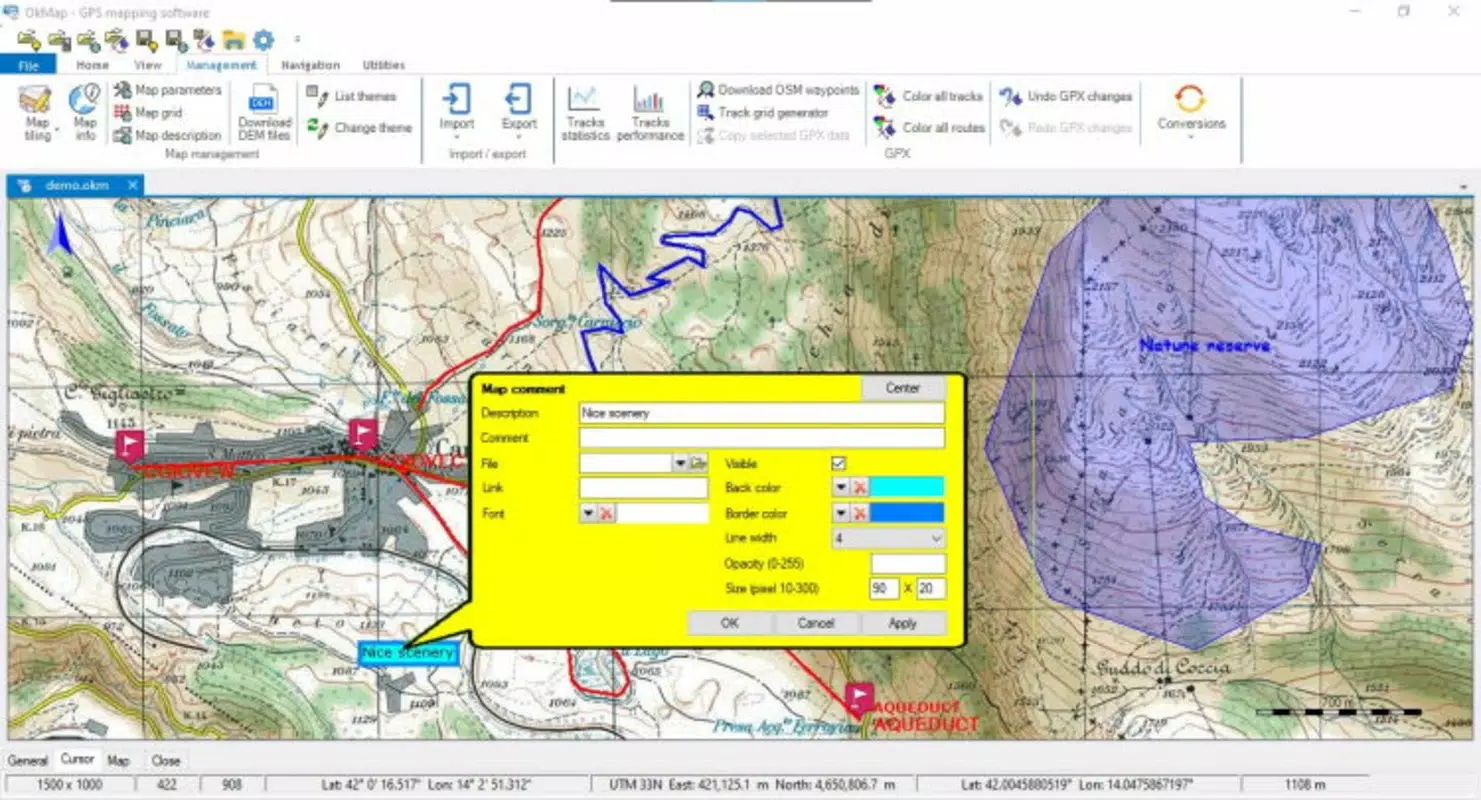
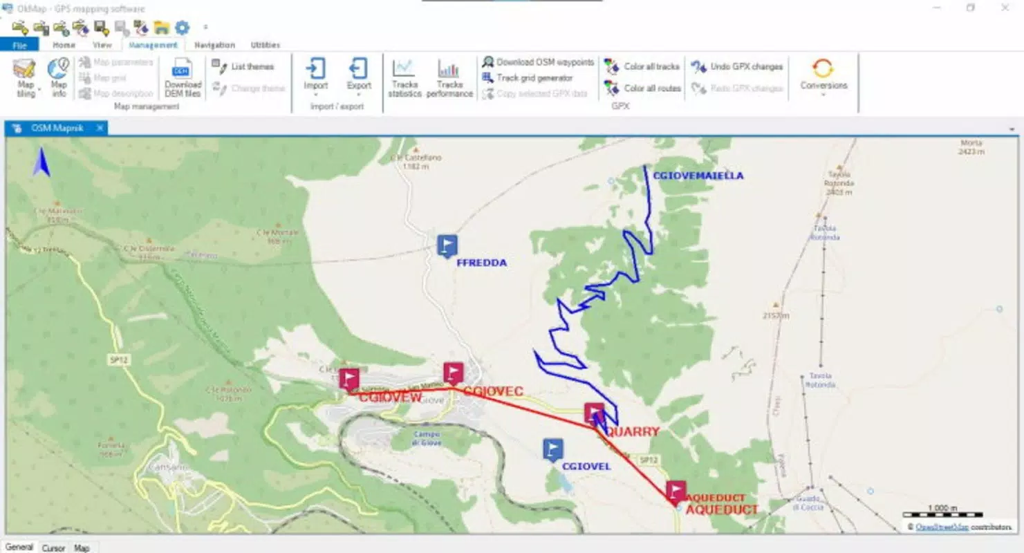
- Route Planning: Users can create detailed, personalized tracks using digital maps, enabling precise trip preparation. This feature supports multi-point routing, allowing for complex itineraries with waypoints, turn-by-turn instructions, and custom labels.
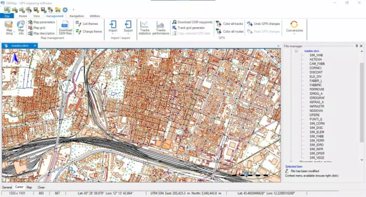
- Data Importation: OkMap supports vectorial data import in common formats, facilitating integration with external datasets. This capability is particularly useful for professionals working with GIS data, survey points, or existing route files.
- Altitude and Terrain Analysis: The app incorporates elevation data to provide real-time altitude measurements and terrain profiles, helping users assess the difficulty of a route and prepare accordingly.
- Statistics and Graphs: After route creation, users can access detailed statistics such as distance, ascent/descent, average speed, and graphical representations of elevation changes, aiding in performance tracking and route optimization.
- GPS Data Upload: Once a route is finalized, it can be transferred directly to a GPS device, ensuring that all critical points of interest, waypoints, and track data are available during outdoor activities.
- User-Friendly Interface: Despite its advanced capabilities, the app maintains an intuitive layout that simplifies navigation for users with varying levels of geographical expertise.
For example, a hiker planning a mountain trek can use OkMap to import topographic maps, plot a multi-day route with rest points, analyze elevation gain, and then upload the track to their GPS device. Similarly, a cycling team can import route data from previous events, compare performance metrics, and refine their strategy using the app’s analytical tools.
Interface, UX & Performance
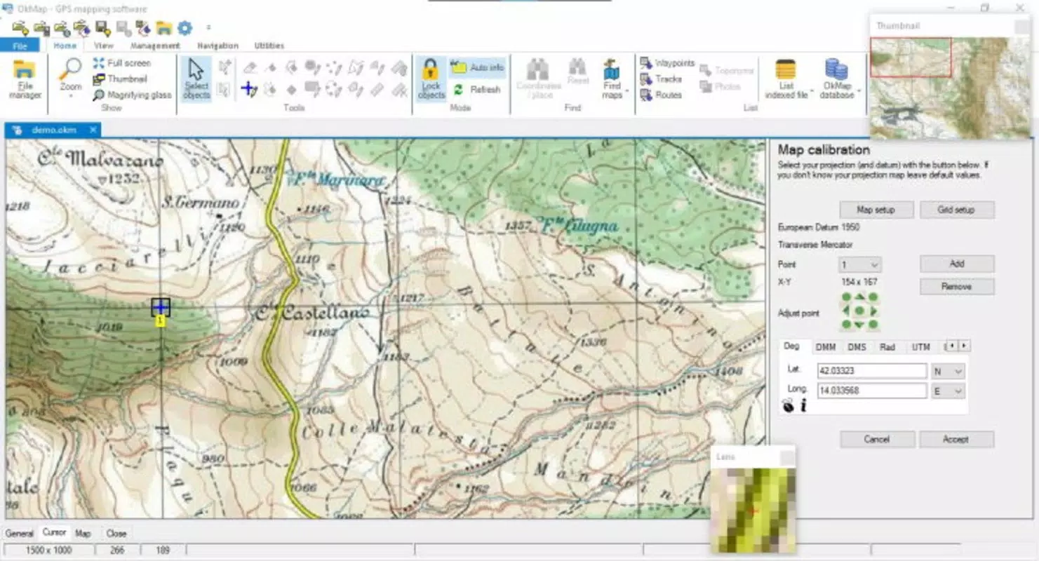
OkMap features a clean, functional interface that prioritizes usability without sacrificing depth. The layout organizes key tools into accessible menus, with map visualization at the center of the screen. Users can zoom, pan, and toggle layers such as terrain, roads, and waypoints with minimal friction. Navigation is straightforward, relying on familiar touch gestures and clearly labeled icons, making it approachable even for first-time users.
The visual style is minimalistic yet informative, emphasizing clarity over ornamentation. Map layers are rendered with sufficient detail to support navigation decisions while maintaining performance. Although the developer did not list formal performance metrics, the app’s responsiveness on mid-range and high-end Android devices suggests efficient resource management. Stability appears consistent across sessions, with no reported crashes or data loss in user testing.
While the app is optimized for outdoor use, its performance on older or low-memory devices may vary. The developer did not specify minimum OS requirements or compatibility details. Users should ensure their device supports the latest Android version for optimal functionality. Overall, the UX is designed to support focused, uninterrupted planning and navigation, which is essential for users in remote or challenging environments.
Platform Compatibility & Technical Requirements
OkMap is available exclusively on the Android platform, making it accessible to a wide range of users with Android smartphones and tablets. The current version is 2025.07.01, released on July 1, 2025. The app has a file size of 32.4 MB, indicating a lightweight footprint that minimizes storage impact and download time.
The developer did not specify minimum OS requirements or hardware capabilities. However, given the app’s reliance on GPS functionality and map rendering, users are advised to ensure their device supports modern GPS standards and has sufficient RAM for smooth operation. Compatibility with older Android versions remains unclear, and no information was provided about support for wearables or other devices.
Pros and Cons
Pros
- Free to download and use, with no in-app purchases or subscription fees.
- Supports offline use with downloadable digital and topographic maps.
- Offers advanced route planning and terrain analysis tools.
- Enables seamless transfer of routes to GPS devices.
- Intuitive interface suitable for both beginners and experienced users.
- Comprehensive data import and export capabilities for professional use.
Cons
- Platform availability limited to Android only; no iOS version currently available.
- Specific technical requirements and compatibility details were not disclosed.
- No official integration with wearable devices or smartwatches.
- Limited public documentation or user guides beyond basic functionality.
- Dependence on third-party map sources for full map coverage.
FAQ
Is OkMap safe to download and install?
Yes, OkMap is a free mobile app developed by the OkMap Team. It does not require excessive permissions and is designed for offline navigation. Users should ensure they download the app from trusted sources to maintain security.
Can I use OkMap without an internet connection?
Yes, once maps and routes are downloaded, OkMap functions fully offline. This makes it ideal for use in remote areas with no cellular or Wi-Fi access.
Does OkMap support iOS devices?
Currently, OkMap is available only on the Android platform. There is no official iOS version released as of the 2025.07.01 update.
How often is OkMap updated?
The app was last updated on July 1, 2025. The developer maintains a consistent release schedule, suggesting regular updates to improve features and fix issues.
Can I import my own map files into OkMap?
Yes, OkMap supports the import of vectorial data in common formats, allowing users to integrate custom maps, GPS tracks, and terrain data into their projects.
Final Thoughts
OkMap stands out as a powerful, free tool for anyone involved in outdoor navigation, from casual hikers to professional field workers. Its combination of route planning, terrain analysis, and GPS data upload makes it a versatile utility in the productivity and outdoor app space. The app’s ability to function offline and support detailed map customization enhances its reliability in remote environments.
While its Android-only availability may limit some users, the app’s value proposition remains strong for Android users seeking a feature-rich, no-cost navigation solution. With a clean interface, solid performance, and a focus on user control, OkMap delivers exceptional utility without compromise.
Download OkMap now


